Remote Sensing and GIS Workshop
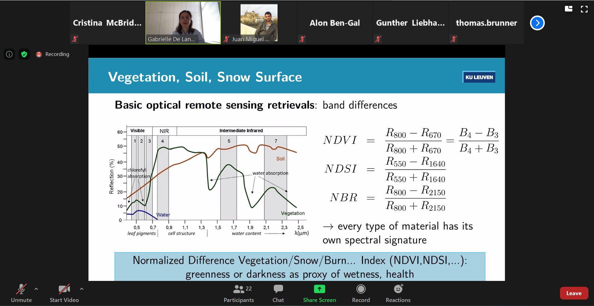
As part of SHui’s virtual General Assembly, two Early Career Training Events were held over Zoom. On Wednesday 22 July 2020, an internal workshop (for SHui project participants) covered the basics of Remote Sensing and Geographic Information Systems (GIS). The event opened with Gabrielle de Lannoy (KU Leuven, Belgium) introducing the theory and practice of remote sensing, covering the major sensing platforms (ground-based, aerially based via drones and aeroplanes, satellites) and wavelength ranges. Retrievals of precipitation and soil moisture data were considered, emphasising the sources of passive and active microwave emission and backscattering. Possibilities to gather evapotranspiration data were mentioned. Then, Aviva Peeters (TerraVisionLab Ltd, Israel) provided an introduction to Online GIS, explaining the various platforms that could be used with publically available data. Lastly, Roujing Li (Beijing Normal University, China) introduced the operation of Google Earth Engine to extract vegetation (NDVI) data, while emphasising the richness of available data sources and the processing pipeline. It was great to see that Early Career Researchers not only attended the workshop, but contributed to its delivery, with project participants from both the EU and China being involved. Despite the technical challenges of the online forum, participants and contributors managed to interact (both audio and text chat) to resolve queries.
Cristina McBride-Serrano, ECR at ULANC:
I found this SHui ECR Training workshop engaging and very useful for my career development. The presentations delivered were clear, interactive, and informative. Overall, my knowledge on the remote sensing of soil moisture and my awareness of different platforms and data sources available have been broadened. This was a good opportunity for those seeking a comprehensive overview of the material provided, even for those with previous knowledge on the subject.
Remote Sensing and GIS Workshop (times are Central European time)
0900 Gabrielle de Lannoy (KU Leuven, Belgium) Introduction to Remote Sensing
1000 Coffee Break
1030 Aviva Peeters (TerraVisionLab Ltd, Israel) Introduction to Online GIS
1130 Coffee Break
1200 Roujing Li (Beijing Normal University, China) Introduction to Google Earth Engine
1300 Close
Learning Outcomes
At the end of the workshop, participants should be able to
- Understand the principles of optical and microwave remote sensing
- Understand the various sensors and platforms used for land surface remote sensing
- Use freely available GIS platforms to work with remote sensing data
0 comments