Keep the soil on the field and let the runoff infiltrate!
Author: Thomas Brunner, PhD Student at BOKU Vienna and BAW-IKT Petzenkirchen
Prior to starting my ongoing educational journey at BOKU Vienna, I realized that anthropogenic climate change and associated detrimental effects on the environment and our civilization are clearly the most urgent and important challenge of our time. I feel morally obliged to dedicate my life (or at least my working hours) to trying to repay our collective debt.
With the limited understanding of environmental problems I had back then, I figured that all of this could be solved by expanding the capacity of hydroelectric power generation, which is why I enrolled at BOKU for the Environmental Engineering program. Ultimately, I let go of this plan and turned my attention to soil and water conservation instead, specifically the reduction of cultivation-accelerated soil erosion. I felt that this problem, which is as old as agriculture itself, was potentially equally dangerous for human existence as we know it, albeit slightly less urgent. Since soil erosion tends to happen in a clandestine way, going unnoticed for a long time, it can be even more ruinous in the end. Finding that this phenomenon had a smaller political lobby than other (less pressing) environmental problems, I decided to become part of this lobby for soil and water conservation myself.
I joined the SHui project at the end of 2019 and have been mostly occupied with using an erosion model (CASE2) to examine the effects of different best management practices (BMPs) , i.e. their potential to decrease soil loss and increase the water volume available for crop growth. This means parameterizing input data for different sites and BMPs, as well as calibrating and validating the model outputs with measured data. While the effect of these BMPs on an individual field are often well understood and easily quantified, examining these effects on larger (catchment) scales requires developing appropriate scenarios and comparing model outputs, as direct measurements are usually very difficult.
Sharing data and ideas within the project provides interesting insights and viewpoints from completely different agricultural systems. For example, while I understand “standard” rainfed cereal and row crop cultivation in Central Europe, I know little about management of irrigated tree crops in the Mediterranean. Of course, there cannot be a single BMP or any collection of them, that act in a “one fits all” fashion to solve all possible management issues. However, synergies in BMPs should be sought such as between soil and water conservation, especially since most of the facts have been known for many years but need some fine-adjustment and implementation.
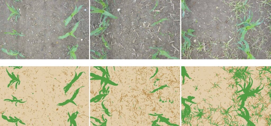
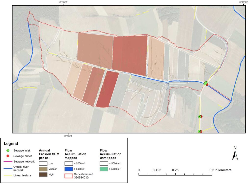
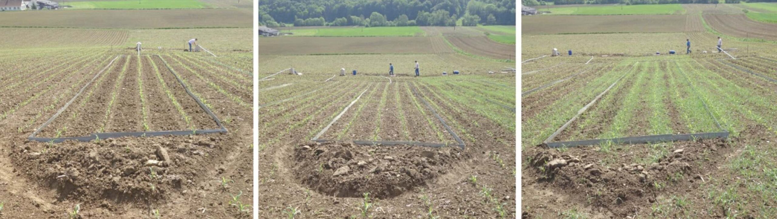
Apart from that, I assist with research at BAW-IKT Petzenkirchen, which aims to reduce both soil loss and surface runoff at catchment scales. For example, Figure 3 shows fields identified as hot spots for soil erosion within a small catchment. I find it a unique place at the interface between research and process understanding, policy (partly) based in this research, agricultural extension services, individual farmers, landscapes and water bodies themselves. There I also maintain a small erosion plot trial with maize to investigate the effects of mulching and intercropping with wheat. Figure 1 shows the different treatments shortly after sowing. The actual difference in soil cover between these treatments, which is a controlling factor of both splash and runoff erosion and the main parameter we want to increase, can be quantified as shown in Figure 2.This field work nicely complements the many hours I spend in front of a computer.
After finishing my PhD some day, I would not mind to simply continue working in this constellation, as I do not think that the problem of bringing more of the known BMPs into practice will be “solved” any time in the near future, but will instead require constant efforts from the science/policy direction. I am not so much interested in the pure science but very much target-oriented and want to see things implemented as well.