Final SHui webinar “Developing Decision Support Models and Tools for Precision Agriculture” report
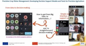
Our final SHui webinar occurred on 2 August, with Alon-Ben Gal (ARO)and Aviva Peeters (TerraVision Lab) showcasing the work they’ve done within WP4 in the area of precision irrigation, by developing models to delineate management zones and predict variability in crop water stress within a field. Over 50 participants from 13 different countries joined in across multiple time zones, with particular mention of those attending from the USA where it was 3 am in the morning !
After some scene-setting conceptual slides, Alon introduced a number of real-life examples from SHui partners (vineyards and peach orchards from Spain and Israel) where spatial data (soil, crop and satellite-based) discriminated different management zones, with their implementation increasing crop yield and quality in some examples but not others. Aviva then demonstrated how utilising easily accessible data (without requiring laborious manual in-field measurements) within new models developed within the project can improve the prediction of variables such as Crop Water Stress Index (CWSI), a Best Management Practice for irrigating vines and other crops.
A new web-based application (Precision Crop Water Management) for utilising spatial data was introduced, to show how input data (e.g. topography) can generate output data (e.g. CWSI) that farmers can use for irrigation management decisions. Watch this space for the release of this application later in the year.
Finally, a question and answer session dealt with the practicalities of applying these tools (e.g. accounting for irrigation inputs, the frequency at which management zones may need re-assigning) and possible impediments in their development or application (e.g. availability of researchers with data science and/or programming skills, the viability of implementation by commercial enterprises varying in size).