Authors: L. Katz, A. Ben-Gal, M. I. Litaor, A. Naor, M. Peres, I. Bahat, Y. Netzer, A. Peeters, V. Alchanatis & Y. Cohen
Abstract
Wide assimilation of precision agriculture among farmers is currently dependent on the ability to demonstrate its efficiency at the field-scale. Yet, most experiments that compare variable-rate vs uniform application (VRA and UA) are performed in strips, concentrated in a small portion of the field with limited extrapolation to the field scale. A spatiotemporal normalized ratio (STNR) methodology is proposed to evaluate the impact of VRA compared with UA for on-farm trials at the field scale. It incorporates a base year in which the whole plot is managed with UA and consecutive years in which half of the plot is managed with UA and the other half is managed with VRA. Additionally, a novel normalized relative comparison index (NRCI) is presented where the ratios of VRA/UA sub-plots are compared between a base year and a consecutive year, for any measured parameter. The NRCI determines the impact of VRA on variability using statistical measures of dispersion (variability measures) and on performance with statistical measures of central tendency (performance measures). Variability measures with NRCI values lower or higher than 1 indicate VRA management decreased or increased variability. Performance measures with NRCI lower or higher than 1 indicate subplot impairment or improvement, respectively due to VRA management. The methodology was demonstrated on a commercial drip irrigated peach orchard and a wine grape vineyard. NRCI results showed that VRA drip irrigation reduced water status in-field variability but did not necessarily increase yield. The benefits and limitations of the proposed design are discussed.
The sustainability of farming systems has been enhanced by legislation on different scales, but at the same time these policies also promote more productive systems through farming intensification (e.g., use of irrigation or high tree densities). This is the case of olive orchard expansion on cereal cropland in recent decades. This study analyses the impact of this expansion on orchard characteristics and landscape elements in a case study in the ’campiña‘ of Cordoba in Southern Spain based on the evolution of their surface and typologies during the period from 2005 to 2018. Our results show that olive orchards doubled their surface after the 13-year period, from 7997.8 to 16,447.6 ha. On average the new orchards tended to have higher plant density and a more frequent use of irrigation in the study period. Despite this trend towards intensification, the current situation shows a majority of rainfed (76.4%) and medium tree densities, 120–200 trees/ha, (42.7%) of the area. Nevertheless, newly intensified orchards are arising in the region, resulting in a mosaic of orchards of different characteristics (slope, tree density, soil type) and agricultural managements (irrigation, ground cover vegetation).
In addition, this characterization was complemented with an inventory of the existing semi-natural elements associated with these orchards to identify the current state of the regional agricultural landscape. A total number of 507 isolated trees and different linear and polygonal landscape elements (343.9 km and 714.0 ha, respectively), mainly segmented, were inventoried. From these polygonal landscape elements, a significant fraction (e.g., slopes, gullies, water banks and non-productive strips/faces) remains unvegetated (57%). Therefore, these elements must be considered in multiscale agricultural policies as potential restoration areas to enhance ecosystem service provisioning.
Authors: Mehtab Muhammad ASLAM, Eyalira J. OKAL, Aisha Lawan IDRIS, Zhang QIAN, Weifeng XU, Joseph K. KARANJA, Shabir H. WANI, Wei YUAN
Abstract
Beneficial root-associated rhizospheric microbes play a key role in maintaining host plant growth and can potentially allow drought-resilient crop production. The complex interaction of root-associated microbes mainly depends on soil type, plant genotype, and soil moisture. However, drought is the most devastating environmental stress that strongly reduces soil biota and can restrict plant growth and yield. In this review, we discussed our mechanistic understanding of drought and microbial response traits. Additionally, we highlighted the role of beneficial microbes and plant-derived metabolites in alleviating drought stress and improving crop growth. We proposed that future research might focus on evaluating the dynamics of root-beneficial microbes under field drought conditions. The integrative use of ecology, microbial, and molecular approaches may serve as a promising strategy to produce more drought-resilient and sustainable crops.
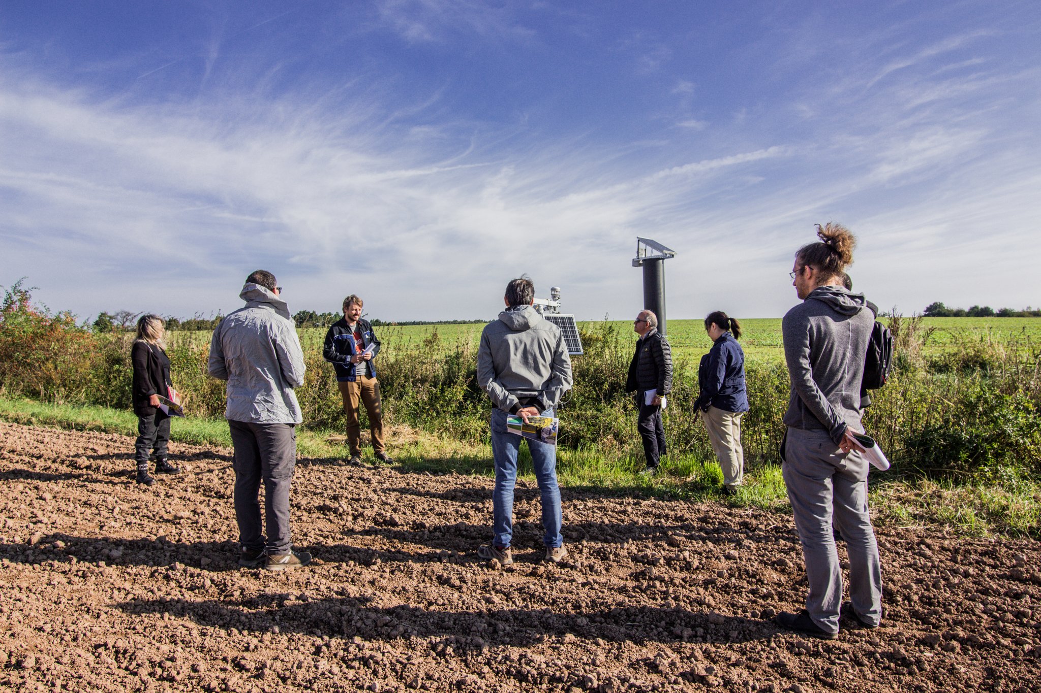
Despite the Christmas season being busy, over 90 registered for SHui’s 5th webinar, entitled Quantifying the Soil-Plant-Atmosphere Continuum. Continuing the trend established by SHui’s September General Assembly, this hybrid event allowed participants to either attend in-person in Lancaster or online on Teams. Although most speakers attended in person, Dr Katharina Huntenburg of the National Institute of Agricultural Botany and Dr Andrew Hirons of University College Myerscough presented remotely. Developing new measurement techniques and applying existing instrumentation in novel ways was a recurrent theme of the symposium, with speakers and attendees drawn from both the academic and commercial worlds.
1 – John Quinton (Lancaster): Detecting soil degradation and restoration
2 – Ryan Edge (Lancaster): Root-soil interactions enhancing crop-soil functions
3 – Vasileios Giannakopoulos (Lancaster): Surfactant effects on plant water relations
4 – Katharina Huntenburg (Lancaster & NIAB): Using MRI to quantify soil and tuber water content of potatoes
5 – Andy Hirons (Lancaster & Myerscough College): Novel techniques for irrigating trees in the nursery
6 – Tony Peloe (Delta-T Devices, UK): Commercial developments in soil water instrumentation
From tropical forests to temperate crops, while chasing soil moisture
Author: Louise Gill, Research technitian at Lancaster University
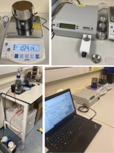
Hi I’m Louise and I am Lancaster’s Research Technician for soil and water in the SHui project. I started the role at the end of 2021, once Cristina transitioned to a PhD, with the arrival of new METER equipment (HYPROP2, its refill unit, and WP4C). My role has mainly been to set up and understand this equipment to produce soil moisture release curves to understand the impacts of different soil management, including trying to discriminate bulk soil versus rhizosheath hydraulic properties.
This equipment is a game changer (figure 1).
Figure 1: The Hyprop 2, WP4C and the Refill equipment and set up of 2 Hyprop 2 and a WP4C while it is displaying the readings the Hyprop scales on the computer software.
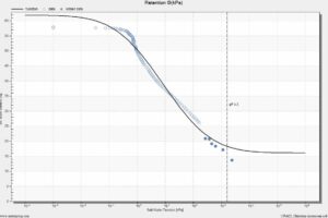
It allows high-resolution soil moisture release curves (below, figure 2) to be produced in a fraction of the time compared to the old methods. Hyprop Fit creates other graphs including weight change over time, conductivity of the Hyprop measurements against soil water tension, and Conductivity (Ktheta) of the Hyprop measurements against volumetric water content. The software fits various hydrological models, which allows the best fit to be chosen.
Figure 2: The Soil Moisture Release Curve created in the Hyprop Fit Software with Kosugi original model fitted.
I’ve collected data that show the soil’s permanent wilting point , which can help land owners determine the correct land management for crops and save water resources from irrigation when it is not required.
I gained a first-class honours degree in Environmental Science from Lancaster University in 2010, where I studied a variety of subjects including hydrology, pollution and soils. My undergraduate dissertation saw me visiting a tropical rainforest in Borneo to measure soil moisture content. During my degree I also volunteered to undertake research in South Africa into small mammals and birds with Operation Wallacea over a summer.
After my degree I started working in a business development department for a grounds maintenance, cemetery management, arboriculture and horticultural company. Here I expanded my knowledge into the improvements environmental research can bring for these businesses by better managing our environment e.g. watering regimes and choice of grass species. Learning about current best practice procedures for maintenance/work made me want to go back into research.
In 2017-2020, while my children were young, I completed my part-time Masters by Research. I looked at how tree canopies can reduce the rainfall that reaches the ground via wet canopy evaporation and therefore reduce flooding risks to communities. I found that trees on the edge of stands can play a large role in reducing the water that reaches the ground in small-medium sized rain events, but they have less effect for large events. Also, trees on the edge collected more rainfall than the area they covered during certain conditions e.g. when the wind direction was towards the open canopy.
I went on to work for the RSPB as a Senior Administrator for the North West region where I saw the benefits that research in partnership with farmers/landowners can make to our environment and the farmers. I wanted to be more involved in the research itself and became Assistant Conservation Officer covering maternity leave where I collated wader survey data and wrote farm wader reports.
From the roles I have undertaken, I have seen the benefits that interdisciplinary research can make to our environment and have an interest in water/soil science. I live in a village where I see local farm land being degraded over winter with no cover crops after maize harvesting, and wanted to be able to work towards providing methods to improving practices to protect the valuable soil and our landscape.
Since starting the Research Technician role, I have learnt more about soil water and various ways of measuring its availability to the plant. It has been interesting to focus on plants/crops and know how this can benefit our planet by maximising water resources for food production. I enjoy collecting data and I hope to be able to continue as a Research Technician in a similar field in the future.
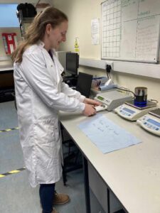
Louise Gill working on the lab
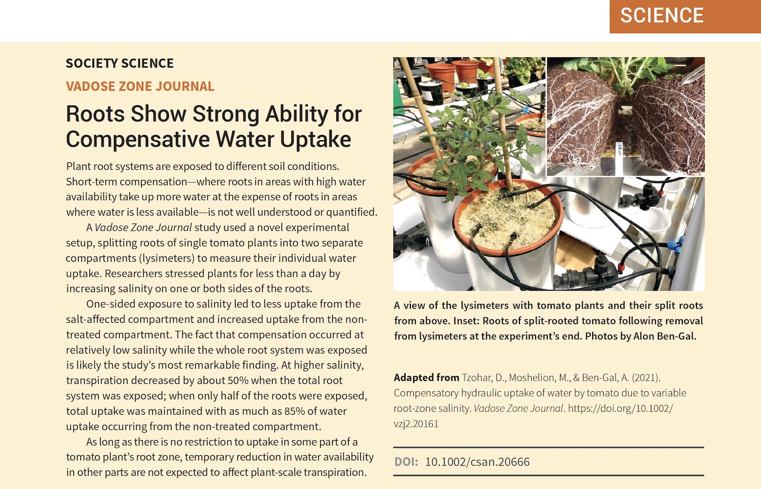
Roots Show Strong Ability for Compensative Water Uptake
Water has always fascinated me. Even though I studied civil engineering subjects, my path led me to water. I am lucky to live in a country with a functioning drinking water supply system. For many years, I didn’t need to ask questions such as: How does the water get in the tap ? & What barriers must be overcome ?
Mains water supplies more than 90% of the Czech population with drinking water. Around one half of this water is sourced from the surface. Historically, ponds were traditionally built to control and use surface water. Many larger reservoirs were constructed during the Communist era of the 1960´s and 1970´s. Most of these depend on surface water, thus on rains. However, heavy rains transport sediment to reservoirs, which is one of the main problems that I focus on.
I’ve studied the effects of land-use change on the conditions in the Vrchlice Reservoir Watershed (near the historical Kutna Hora town), which has been highly affected by sediment input. The original forests were transformed to agricultural land. Later, in the 20th century, small parcels of lands were consolidated into large fields. Even though more people now use words such as sustainable, ecological, etc., and some areas have recovered from the intensive farming of the Communist era, soil loss and sediment transport to reservoirs still occurs.
I started to work with a USLE based model, to simulate sediment production and its transport to rivers and ponds. To collect data for calibration, I went to the fields with my colleagues many times, to measure sediment volumes in several ponds. This is the most beautiful part of my work, spending a day in nature by the water. By running the calculations for different scenarios, I wanted to determine whether historical development, land-use change or crop rotations had the most significant effect on sediment distribution across the watershed. Using the model to locate areas with high potential for sediment production was another part of my study, to inform the introduction of erosion control measures.
The SHui project, which I am happy to be part of, has let me see other landscapes, countries, and continents, with their beauty and (soil and water management) issues. Seeing many international teams cooperate gives me hope that we can return to a more sustainable landscape management.
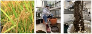
Rice rhizosheath development – A Visitor’s perspective of research in Lancaster
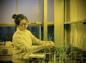
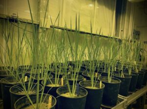
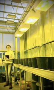
I’m Jing Chen, a PhD student from Yangzhou University (laboratory of Prof Jianchang Yang from SHui’s Advisory Board), and I’ve been able to visit Lancaster thanks to scholarships of Jiangsu Provincial Government and Yangzhou University. I am continuing my study by investigating rhizosheath development of rice plants under different irrigation regimes, part-supported by the SHui Program, in Prof Ian Dodd’s laboratory at the Lancaster Environment Center (LEC).
Rice (Oryzasativa L) is one of the most important food crops in the world. However, increasing water scarcity in many rice cropping regions has stimulated many water-saving regimes in irrigated rice, such as the moderate soil drying irrigation to enhance water use efficiency. These irrigation techniques stimulate the rice roots to preferentially form rhizosheaths, comprising soil particles that adhere to the root system after it has been extracted from the soil.
After attending the Delta-T training workshop within the SHui Project, I’ve learned how to best use the porometer and various probes to measure stomatal conductance and soil moisture and other soil properties. Many of my co-workers have helped me to germinate better seedlings, operate the WinRHIZO software to measure root length, use thermocouple psychrometry to determine leaf water potential and image analysis software on the microscope to determine root hair length and root hair length density. I’ve enjoyed meeting new colleagues from different parts of the world, and enhanced my research ability thanks to Prof Ian Dodd’s patient and professional advice on experimental design and data analysis.
Performance analysis of regional AquaCrop (v6.1) biomass and surface soil moisture simulations using satellite and in situ observations
Authors: Shannon de Roos, Gabriëlle J. M. De Lannoy, and Dirk Raes
Abstract
The current intensive use of agricultural land is affecting the land quality and contributes to climate change. Feeding the world’s growing population under changing climatic conditions demands a global transition to more sustainable agricultural systems. This requires efficient models and data to monitor land cultivation practices at the field to global scale.
This study outlines a spatially distributed version of the field-scale crop model AquaCrop version 6.1 to simulate agricultural biomass production and soil moisture variability over Europe at a relatively fine resolution of 30 arcsec (∼1km). A highly efficient parallel processing system is implemented to run the model regionally with global meteorological input data from the Modern-Era Retrospective analysis for Research and Applications version 2 (MERRA-2), soil textural information from the Harmonized World Soil Database version 1.2 (HWSDv1.2), and generic crop information. The setup with a generic crop is chosen as a baseline for a future satellite-based data assimilation system. The relative temporal variability in daily crop biomass production is evaluated with the Copernicus Global Land Service dry matter productivity (CGLS-DMP) data. Surface soil moisture is compared against NASA Soil Moisture Active–Passive surface soil moisture (SMAP-SSM) retrievals, the Copernicus Global Land Service surface soil moisture (CGLS-SSM) product derived from Sentinel-1, and in situ data from the International Soil Moisture Network (ISMN). Over central Europe, the regional AquaCrop model is able to capture the temporal variability in both biomass production and soil moisture, with a spatial mean temporal correlation of 0.8 (CGLS-DMP), 0.74 (SMAP-SSM), and 0.52 (CGLS-SSM). The higher performance when evaluating with SMAP-SSM compared to Sentinel-1 CGLS-SSM is largely due to the lower quality of CGLS-SSM satellite retrievals under growing vegetation. The regional model further captures the short-term and inter-annual variability, with a mean anomaly correlation of 0.46 for daily biomass and mean anomaly correlations of 0.65 (SMAP-SSM) and 0.50 (CGLS-SSM) for soil moisture. It is shown that soil textural characteristics and irrigated areas influence the model performance. Overall, the regional AquaCrop model adequately simulates crop production and soil moisture and provides a suitable setup for subsequent satellite-based data assimilation.
Authors: by Nina Noreika, Julie Winterová, Tailin Li, Josef Krása and Tomáš Dostál.
Abstract
For the Czech Republic to recover from the effects of past mismanagement, it is necessary to determine how its landscape management can be improved holistically by reinforcing the small water cycle. We conducted a scenario analysis across four time periods using SWAT (Soil and Water Assessment Tool) to determine the effects of land use, land management, and crop rotation shifts since the 1800s in what is now the Czech Republic. The 1852 and 1954 land-use scenarios behaved the most similarly hydrologically across all four scenarios, likely due to minimal landscape transformation and the fact that these two scenarios occur prior to the widespread incorporation of subsurface tile drainages across the landscape. Additionally, the crop rotation of 1920–1938 reinforces the small water cycle the most, while that of 1950–1989 reinforces the small water cycle the least. Diversified crop rotations should be incentivized to farmers, and increasing the areas of forest, brush, and permanent grassland should be prioritized to further reinforce the small water cycle. It is necessary to foster relationships and open communication between watershed managers, landowners, and scientists to improve the small water cycle and to pave the way for successful future hydrological modeling in the Czech Republic.
We use cookies to ensure that we give you the best experience on our website. If you continue to use this site we will assume that you are happy with it.OkPrivacy policy