Managing water scarcity in European and Chinese cropping systems

In INTERNATIONAL JOURNAL OF ENVIRONMENTAL RESEARCH AND PUBLIC HEALTH

Authors: Istanbuly, Mustafa Nur; Krasa, Josef; Jabbarian Amiri, Bahman

Abstract

Most studies that address the relationship between socio-economic characteristics and soil erosion focus on the effects of soil erosion on socio-economic conditions at different levels, from global to smallholder. Few, if any, efforts are made to address the influence of socio-economic variables on the soil erosion rate as an indicator of landscape degradation. The present study was carried out using spatial data from 402 catchments that cover Poland, to find out how socio-economic variables, which include area-weighted average income per capita (PLN km−2), area-weighted average gross domestic product (PLN km−2), population density (person km−2), and human development index can drive the soil erosion rate (kg ha−1 yr−1), along with annual precipitation, soil and geomorphological variables that include soil organic carbon content, soil water content, clay ratio, stream gradient, and terrain slope. The results showed that the soil erosion rate is indirectly driven by the socio-economic variables in the study catchments, as it is alleviated by increasing population density, the area-weighted average gross domestic product, and the human development index. Furthermore, analyzing the incremental relationship between soil erosion rate and the area-weighted average of socio-economic variables revealed that no uniform change can be observed in the relationship between the area-weighted average socio-economic variables and soil erosion in the study catchments.

Read the full paper here.

In 2021 IEEE INTERNATIONAL WORKSHOP ON METROLOGY FOR AGRICULTURE AND FORESTRY (IEEE METROAGRIFOR 2021)

Authors: Jerabek, Jakub; Zumr, David; Dostal, Tomas; Tenreiro, Tomas R.; Strauss, Peter; Vaverkova, Magdalena D.

Abstract

Soil hydraulic properties (SHP) can be affected by many different factors including: management practices (tillage practices, crop residue management), land use, or natural phenomena (fires, intensive rainfall, drought). Changes in SHP may have a negative impact on infiltration, soil water balance or plant water availability. Although changes of SHP caused by tillage or fires have been vastly studied, such studies are usually restricted to a specific area or do not study the subsequent effects of the changed soil on water movement. In this paper, we present a modelling case-study of the intra-seasonal soil water dynamics at several locations that were subjected to topsoil changes due to tillage management or fire. The effects of no-tillage (NT), minimum, reduced, or other types of non-conventional (alternative) tillage (AT), mulch application (MU), and fire (BURNED) were compared with the effects of conventional tillage (CT) on the soil water dynamics. The changes in SHP due to tillage practices and fire were obtained from the literature. All management practices and fire effects were tested using numerical simulation at three European catchments. According to the literature review, compared to CT, the MU and BURNED treatments affected soil hydraulic properties significantly. NT and AT also influence them, but to a lesser extent. The results of this modelling exercise replicate the effects of tillage on the SHP. The most persistent positive effect on soil water dynamics was under MU treatment. The effect of NT and AT were site specific, suggesting that these results must not be generalized or extrapolated without cautious considerations on the local conditions. BURNED exhibited the most negative effect on soil water dynamics in most cases.

Read the full paper here.

In 2021 IEEE INTERNATIONAL WORKSHOP ON METROLOGY FOR AGRICULTURE AND FORESTRY (IEEE METROAGRIFOR 2021)

Authors: Li, Tailin; Jerabek, Jakub; Zumr, David; Noreika, Nina; Dostal, Tomas

Abstract

A good understanding of soil moisture spatial patterns is useful for assessing the hydrological connectivity and runoff generation processes in a catchment. Thus, we have applied numerical modelling approaches to investigate the spatial patterns of soil moisture at the Nučice experimental catchment (0.531 km 2 ) in the Czech Republic. The catchment was established in 2011 to observe the rainfall-runoff processes, soil erosion and water balance in an agricultural landscape. The catchment consists of three fields covering over 95 % of the area. Eight field surveys were conducted to capture the soil moisture patterns at different scales. Even though the soil management and soil properties in the fields of Nučice seem to be nearly homogeneous, we have observed spatial variability in topsoil moisture. In numerical simulations, a 3D spatially-distributed model MIKE-SHE was used to simulate the water movement within the catchments. The MIKE-SHE simulation has been mainly calibrated with rainfall-runoff observations and point-scale soil moisture data. In the simulation, we have obtained the spatial patterns of soil moisture at each time step. The soil moisture spatial patterns from the simulation have been compared with the density of the vegetation cover (NDVI), and topsoil moisture patterns from field surveys. We found that the density of vegetation cover has a good correlation with the soil moisture spatial distribution. However, this correlation was not captured in the MIKE-SHE simulation. Future research will include Cosmic-ray neutron sensing and stable isotope analysis to improve the current understanding of the catchment.

Read the full paper here.

In Water

Authors: Istanbuly, Mustafa Nur; Dostal, Tomas; Jabbarian Amiri, Bahman

Abstract

In this study, the soil erosion regulation ecosystem services of the CORINE land use/ land cover types along with soil intrinsic features and geomorphological factors were examined by using the soil erosion data of 327 catchments in Poland, with a mean area of 510 ± 330 km2, applying a multivariate regression modeling approach. The results showed that soil erosion is accelerated by the discontinuous urban fabric (r = 0.224, p ≤ 0.01), by construction sites (r = 0.141, p ≤ 0.05), non-irrigated arable land (r = 0.237, p ≤ 0.01), and is mitigated by coniferous forest (r = −0.322, p ≤ 0.01), the clay ratio (r = −0.652, p ≤ 0.01), and the organic content of the soil (r = −0.622, p ≤ 0.01). The models also indicated that there is a strong relationship between soil erosion and the percentage of land use/land cover types (r2 = [0.62, 0.82, 0.83, 0.74]), i.e., mixed forest, non-irrigated arable land, fruit trees and berry plantations, broad-leaf forest, sport and leisure facilities, construction sites, and mineral extraction sites. The findings show that the soil erosion regulation ecosystem service is sensitive to broadleaf forests, rainfed agriculture, soil water content, terrain slope, drainage network density, annual precipitation, the clay ratio, the soil carbon content, and the degree of sensitivity increases from the broadleaf forest to the soil carbon content.

Read the full paper here.

In Agronomy

Authors: Arias-Giraldo, Luis F.; Guzman, Gema; Montes-Borrego, Miguel; Gramaje, David; Gomez, Jose A.; Landa, Blanca B.

Abstract

Among the agricultural practices promoted by the Common Agricultural Policy to increase soil functions, the use of cover crops is a recommended tool to improve the sustainability of Mediterranean woody crops such as olive orchards. However, there is a broad range of cover crop typologies in relation to its implementation, control and species composition. In that sense, the influence of different plant species on soil quality indicators in olive orchards remains unknown yet. This study describes the effects of four treatments based on the implementation of different ground covers (CC-GRA: sown cover crop with gramineous, CC-MIX: sown cover crop with a mixture of species and CC-NAT: cover crop with spontaneous vegetation) and conventional tillage (TILL) on soil erosion, soil physicochemical and biological properties after 8 years of cover crop establishment. Our results demonstrated that the presence of a temporary cover crop (CC), compared to a soil under tillage (TILL), can reduce soil losses and maintain good soil physicochemical properties and modify greatly the structure and diversity of soil bacterial communities and its functioning. The presence of a homogeneous CC of gramineous (Lolium rigidum or Lolilum multiflorum) (CC-GR) for 8 years increased the functional properties of the soil as compared to TILL; although the most relevant change was a modification on the bacterial community composition that was clearly different from the rest of treatments. On the other hand, the use of a mixture of plant species (CC-MIX) as a CC for only two years although did not modify greatly the structure and diversity of soil bacterial communities compared to the TILL soil, induced significant changes on the functional properties of the soil and reverted those properties to a level similar to that of an undisturbed soil that had maintained a natural cover of spontaneous vegetation for decades (CC-NAT).

Read the full paper here.

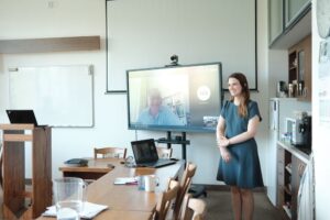
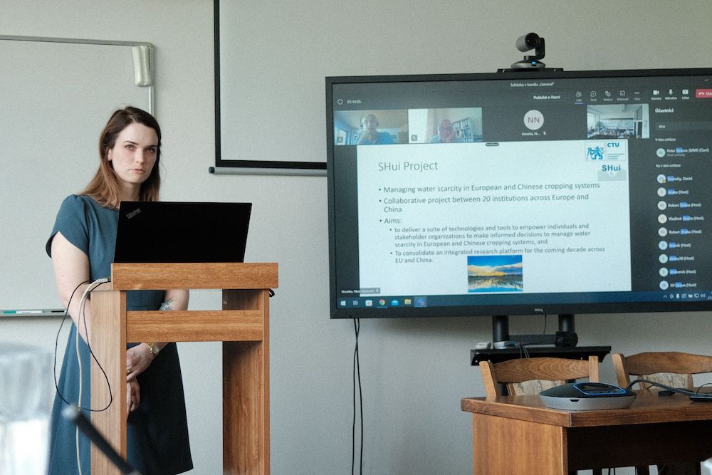
On Monday 27 June 2022, Dr Nina Noreika of the Czech Technical University, successfully defended her PhD thesis, entitled Modelling hydrological impacts of management practices in rural catchments using SWAT. Nina was exclusively involved with, and financed by, the SHUi project, and is the first of our European Early Career Researchers to achieve this milestone, despite the challenges of covid lockdowns. In keeping with the times, she defended her thesis in a hybrid format to an examining committee comprising:

  • Prof Martin Hanel (Czech Academy of Life Sciences)
  • Dr David Stransky (Czech Technical University)
  • Prof Andreas Klik (University of Natural Resources and Life Sciences, Vienna, Austria)
  • Dr Josef Krasa (Czech Technical University)
  • Dr Peter Strauss (Managing Director at the Federal Agency for Water Management, Austria)
  • Prof Milena Cislerova (Czech Technical University)

You can read about Nina’s motivations to pursue PhD studies here. Her successful defence was widely anticipated following her extensive research within the project, being involved in publishing 7 papers including the 3 first author ones that formed the nucleus of her thesis.

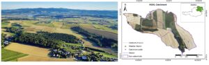
Initially, Nina conducted scenario analyses using the Soil and Water Assessment Tool (SWAT) to determine the effects of planting biofuels (rapeseed) on water balance, showing that attempts to enhance energy sustainability were compromising sustainable water management. You can read the details of this study here. While this paper examined the impact of current biofuel policies, she continued to use SWAT-based scenario analysis to historically examine how changes in crop management over successive Czech political eras has affected hydrological flows in the landscape. Past eras with minimal landscape transformation and the absence of subsurface tile drainages reinforced the small water cycle, with future diversification of crop rotations and increased area of forest and permanent grassland opening possibilities to reverse damage. The ability of SWAT to model at varying scales allowed a more recent study evaluating different conservation agriculture practices, with contour farming and residue incorporation particularly effective at farm-scale. Incentivising farmers to adopt these techniques will be critical to realise benefits at larger scales.

While she will remain in the Czech Republic in the short-term to finish up work of the SHUi project, Nina has recently accepted a position with Arup (a private company) in Bristol, UK as a Senior Catchment and Natural Flood Management Specialist. Starting in October, this clearly indicates that the PhD training provided within the SHui project, especially by her host institution, is providing graduates with relevant skills, attractive to prospective employers.

I am so thankful for my time associated with the SHui project. The last four years working in the SHui community have taught me how invaluable collaboration is. SHui provided not only funding for my research, but also various early career researcher resources and webinars to expand my field of interest. SHui also gave me the ability to travel across Europe to collaborate across organizations or to attend conferences.  I can’t imagine my last four years spent in Prague without the SHui project, and I’ll be forever grateful for this opportunity.

Link to the dissertation: https://dspace.cvut.cz/handle/10467/102671?show=full

In Hydrology and Earth System Sciences

Authors: Shengping Wang, Borbala Szeles, Carmen Krammer, Elmar Schmaltz, Kepeng Song, Yifan Li, Zhiqiang Zhang, Günter Blöschl, and Peter Strauss

Abstract

Climate change and agricultural intensification are expected to increase soil erosion and sediment production from arable land in many regions. However, to date, most studies have been based on short-term monitoring and/or modeling, making it difficult to assess their reliability in terms of estimating long-term changes. We present the results of a unique data set consisting of measurements of sediment loads from a 60 ha catchment – the Hydrological Open Air Laboratory (HOAL) – in Petzenkirchen, Austria, which was observed periodically over a time period spanning 72 years. Specifically, we compare Period I (1946–1954) and Period II (2002–2017) by fitting sediment rating curves (SRCs) for the growth and dormant seasons for each of the periods. The results suggest a significant increase in sediment loads from Period I to Period II, with an average of 5.8 ± 3.8 to 60.0 ± 140.0 t yr−1. The sediment flux changed mainly due to a shift in the SRCs, given that the mean daily discharge significantly decreased from 5.0 ± 14.5 L s−1 for Period I to 3.8 ± 6.6 L s−1 for Period II. The slopes of the SRCs for the growing season and the dormant season of Period I were 0.3 and 0.8, respectively, whereas they were 1.6 and 1.7 for Period II, respectively. Climate change, considered in terms of rainfall erosivity, was not responsible for this shift, because erosivity decreased by 30.4 % from the dormant season of Period I to that of Period II, and no significant difference was found between the growing seasons of periods I and II. However, the change in sediment flux can be explained by land use and land cover change (LUCC) and the change in land structure (i.e., the organization of land parcels). Under low- and median-streamflow conditions, the land structure in Period II (i.e., the parcel effect) had no apparent influence on sediment yield. With increasing streamflow, it became more important in controlling sediment yield, as a result of an enhanced sediment connectivity in the landscape, leading to a dominant role under high-flow conditions. The increase in crops that make the landscape prone to erosion and the change in land uses between periods I and II led to an increase in sediment flux, although its relevance was surpassed by the effect of parcel structure change under high-flow conditions. We conclude that LUCC and land structure change should be accounted for when assessing sediment flux changes. Especially under high-flow conditions, land structure change substantially altered sediment fluxes, which is most relevant for long-term sediment loads and land degradation. Therefore, increased attention to improving land structure is needed in climate adaptation and agricultural catchment management.

Read the full paper here.

In Sustainability

Authors: Winterová J, Krása J, Bauer M, Noreika N, Dostál T

Abstract

The Czech landscape has undergone various changes over the last 100 years and has been mainly adapted agriculturally for economic purposes. This has resulted, among other things, in reservoirs being clogged with sediment. The Vrchlice Reservoir was built in 1970 to supply drinking water for around 50,000 inhabitants, and increased sedimentation has been detected in the reservoir in recent years. Water erosion and sediment transport were modeled with WaTEM/SEDEM. Sediment volumes were measured in eight ponds across the watershed for calibration purposes. Modeled results from ponds in watersheds covered mostly with arable lands generally corresponded with the measured values. Although in forested watersheds, the measured sediment volumes greatly exceeded modeled sediment yields, indicating high uncertainty in using USLE-based models in non-agricultural watersheds. The modeled scenarios represented pre-Communist, Communist, and post-Communist eras. For these periods WaTEM/SEDEM was used to evaluate three isolated effects: the effects of various crops on arable lands, the effects of farmland fragmentation, and finally the effects of changes in land use. The change in crops proved to be an important factor causing high siltation rate (potential 23% reduction in sediment yield for historical periods), and land fragmentation played the second important role (potential 15% reduction in sediment yield can be reached by land fragmentation). Across all scenarios, the lowest sediment yield and reservoirs siltation rates were obtained from the pre-Communist and Communist crop share under current land use conditions, and current land use with farmland fragmentation implemented, as it was re-constructed for the pre-Communist era. This supports the idea that the introduction of green areas within arable lands are beneficial to the landscape and can help reduce soil erosion and reservoir siltation.

Read the full paper here.

In European Journal of Agronomy

Authors: Tomás R. Tenreiro, Jakub Jeřábek, José A.Gómez, David Zumr, Gonzalo Martínez, Margarita García-Vila, and ElíasFereres

Abstract

Spatial variations of crop yields are commonly observed in typical rainfed systems worldwide. It is accepted that such variations are likely to be associated, among other factors, with water spatial variations due to lateral water flows occurring in fields with undulating topography. However, some of the main processes governing water spatial distribution such as lateral flow are not entirely considered by the most commonly adopted crop simulation models. This brings uncertainty to the process of yield simulation at field-scale, especially under water-limited conditions. Although it is expected that lateral water movement determines spatial variations of crop yields, it is still unclear what is the net contribution of lateral water inflows (LIF) to spatial variations of rainfed yields in fields of undulating topography. In this sense, by combining field experimentation, simulation models (HYDRUS-1D and AquaCrop), and the use of artificial neural networks, we assessed the occurrence and magnitude of LIF, and their impact on wheat yields in Cordoba, Spain, over a 30-year period. Seasonal precipitation varied over 30 years from 212.8 to 759.5 mm, and cumulative LIF ranged from 30 to 125 mm. The ratio of seasonal cumulative LIF divided by seasonal precipitation varied from 10.7% to 38.9% over the 30 years. The net contribution of LIF to spatial variations of rainfed potential yields showed to be relevant but highly irregular among years. Despite the inter-annual variability, typical of Mediterranean conditions, the occurrence of LIF caused simulated wheat yields to vary + 16% from up to downslope areas of the field. The net yield responses to LIF, in downslope areas were on average 383 kg grain yield (GY) ha−1, and the LIF marginal water productivity reached 24.6 ( ± 13.2) kg GY ha−1 mm−1 in years of maximum responsiveness. Decision makers are encouraged to take water spatial variations into account when adjusting management to different potential yielding zones within the same field. However, this process is expected to benefit from further advances in in-season weather forecasting that should be coupled with a methodological approach such as the one presented here.

Read the full paper here.

Author: Francis Musyoka, BOKU

It has been widely stated that we did not inherit the earth from our ancestors, but rather we borrowed it from our children. This statement is especially true for agricultural soils and water resources. If we do not make an effort to conserve the soil, then we will be answerable to future generations. Agriculture provides us with food for nutrition, health, and survival, and it is also an income earner for many individuals and families. A rapidly increasing world population greatly increases food demand, which puts substantial pressure on our agricultural lands. To feed this growing population, we may damage our land and water resources.

Water is an important resource for agricultural food production. My passion for a sustainable future led to an MSc. program in water engineering at the Pan African University (PAUWES) in Tlemcen, Algeria. There I developed an interest in catchment hydrology and hydrological modeling. I realized that models, when well utilized, serve as important tools to provide cost-effective and time-efficient evaluations of different hydrological aspects at both catchment and field scales.

Figure 1. Aerial view of the HOAL catchment (left) and elevation, agricultural fields and location of the outlet (right)

My research within SHui focuses on improving agricultural productivity while also taking cautious steps toward managing soil erosion and minimizing water pollution from agricultural sources. The Institute of Soil Physics and Rural Water Management (SoPhy) at the University of Natural Resources and Life Sciences, Vienna (BOKU) has offered me the opportunity and the resources to learn and advance my skills in hydrological modeling using the SWAT model. My goal is to integrate hydrological modeling and field observation data to provide realistic predictions and assessments of soil and nutrient loss from agricultural fields.

The HOAL catchment is an extensively monitored watershed, and therefore high-quality data is available. My PhD project focuses on developing a multi-level approach to model calibration and validation for the SWAT model. The calibrated model will thereafter be used to evaluate agricultural management practices and propose methods for improving agricultural productivity while also conserving soil and water.