Managing water scarcity in European and Chinese cropping systems

As part of SHui’s virtual General Assembly, two Early Career Training Events were held online.

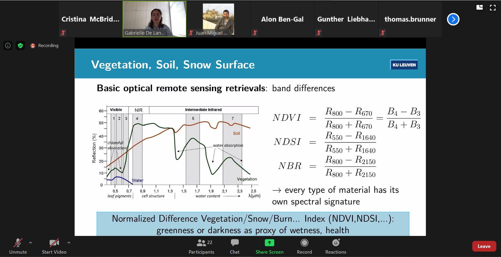
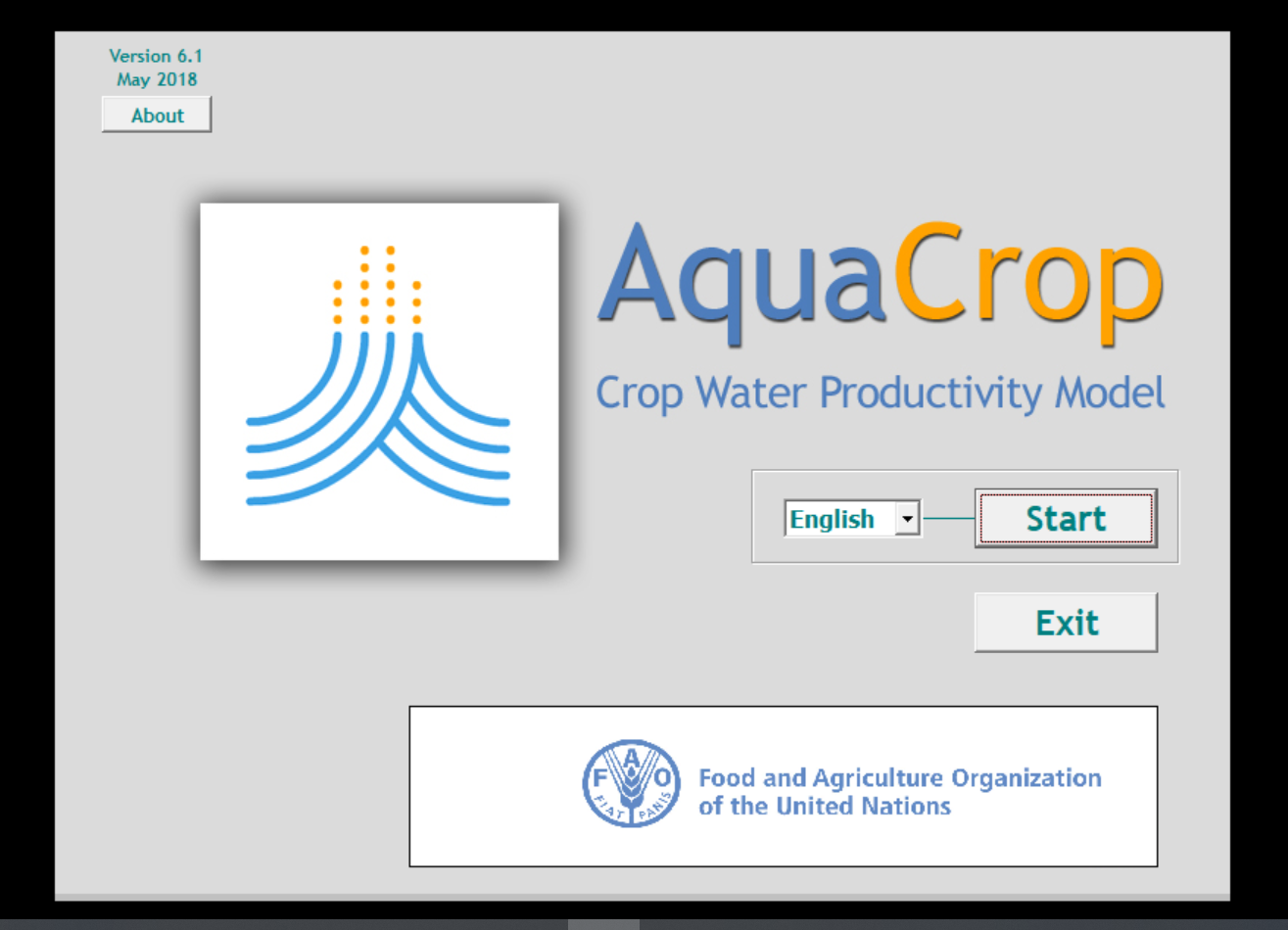
From 20th-24th July 2020, the University of Cordoba (Spain) organised an online workshop ‘How to calibrate and validate the AquaCrop model’. AquaCrop is a crop growth model that simulates crop yield and biomass response to water. This model, developed by FAO, is amongst SHui’s tools to aid individuals and stakeholders in the decision-making process of managing water scarcity in European and Chinese cropping systems.

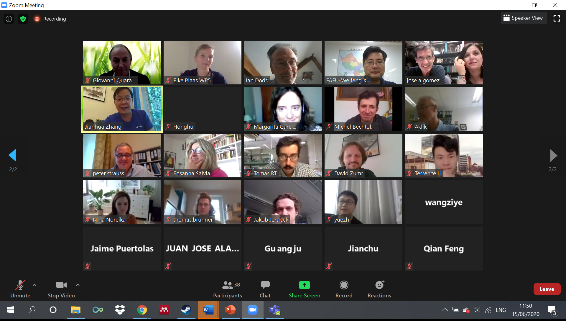
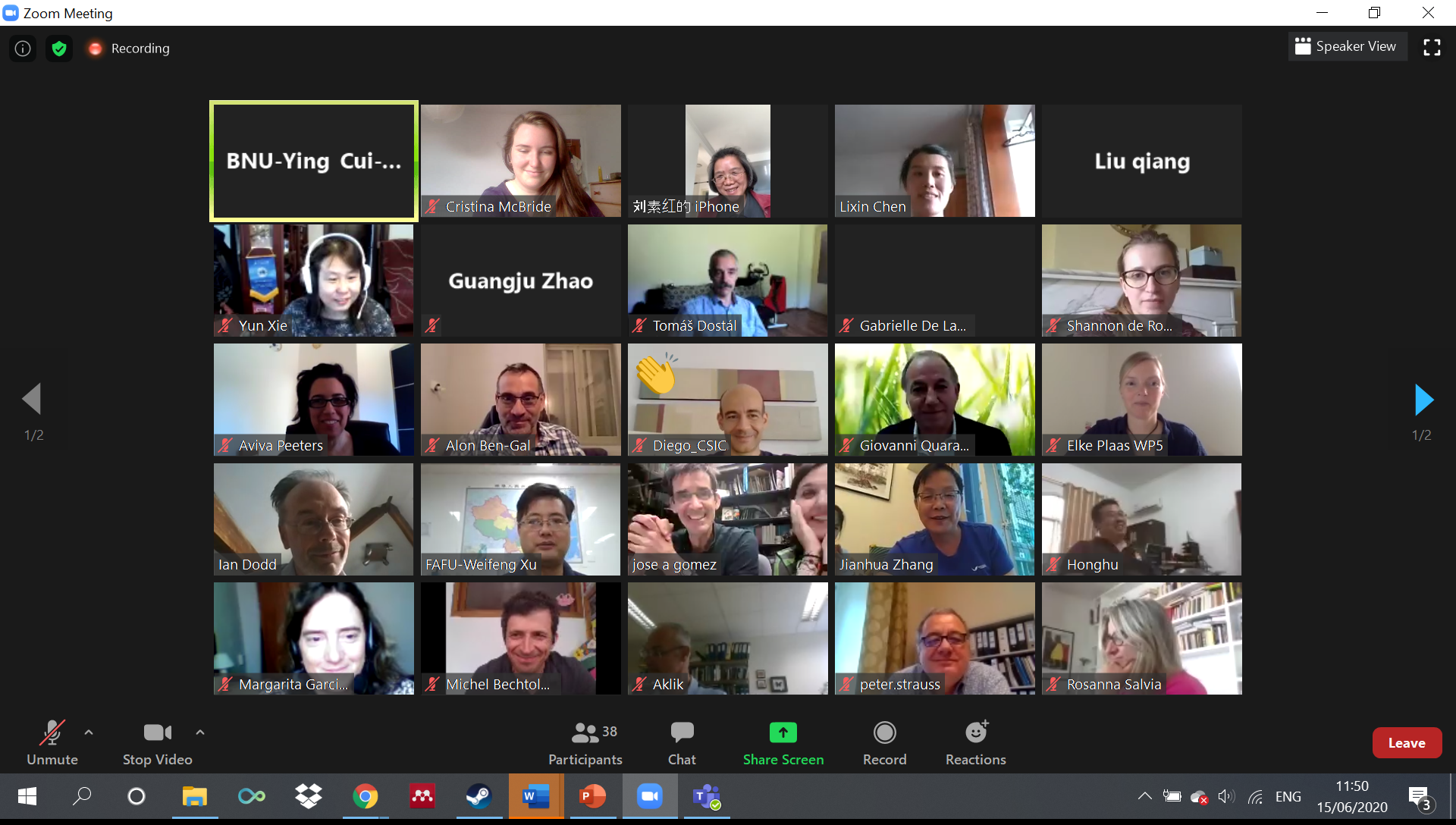
The workshop was delivered by Prof. Elias Fereres and Dr. Margarita Garcia-Vila via the e-learning platform Moodle, and was attended by 80 participants from 33 countries and 4 continents (Africa, America, Asia and Europe) including SHui partners and professionals, engineers and researchers interested in the calibration and validation of AquaCrop.

By the end of the week, participants aimed to calibrate the model with their own dataset/s. The specific objectives of the workshop were:

  • to delineate the calibration and validation processes for the AquaCrop model and to describe the required datasets;
  • to carry out exercises needed to provide a deep understanding of the calibration/validation processes of AquaCrop by the participants;
  • to support participants in their own calibration/validation efforts by providing adequate guidance throughout the Workshop.

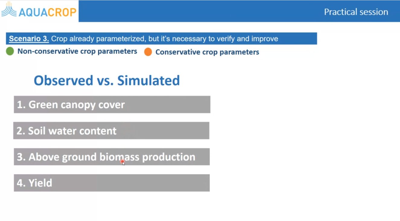
After two introductory webinars, the calibration and validation processes of conservative and non-conservative parameters of AquaCrop version 6.1 were shown by Dr. Margarita Garcia-Vila via three practical sessions. The datasets used were made available for attendees to practice before calibrating and validating their own data. Prof. Elias Fereres and Dr. Margarita Garcia-Vila created a welcoming environment and encouraged interaction, resolving attendees’ queries throughout both the morning practicals and the afternoon open-desk sessions. The sessions were recorded and made available for 15 days.


Shannon de Roos, ECR at KU Leuven: “For me it was helpful to get a better feeling of which parameters are important for both the calibration and validation process, since I mostly work with the source code of AquaCrop. The recordings were especially useful to check your own work on the exercises and to repeat some parts you might have missed. Thank you, Margarita and Elias!”​


Workshop programme


Session 1. Introduction (20 July, 13:00-14:00 CEST)
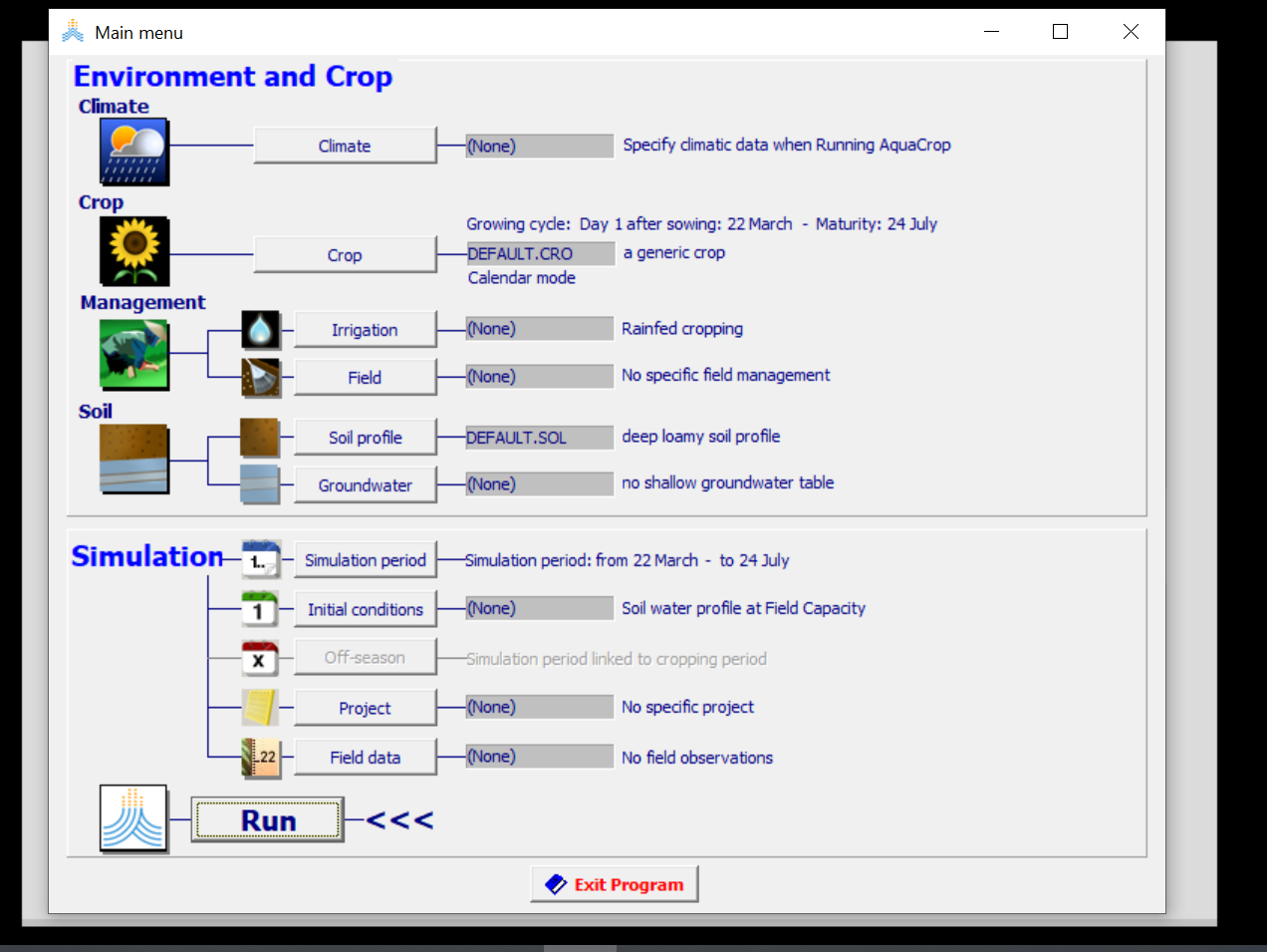
What are the principles and main features of AquaCrop?
What is the calculation scheme of the model?
Is it necessary to calibrate/validate AquaCrop?


Session 2. Calibration and validation processes (21 July, 13:00-14:00 CEST)
What are the datasets needed?
What are the general steps in the calibration and validation processes?
How are the simulation results assessed?
General indications for input files preparation


Session 3. Practical session (22 July, 13:00-14:00 CEST, plus Open Desk 16:00-17:00 CEST)
Adjustment of general parameters


Session 4. Practical session (23 July, 13:00-14:00 CEST plus Open Desk 16:00-17:00 CEST)
Adjustment of parameters for crop response to stresses


Session 5. Practical session (24 July, 13:00-14:00 CEST)
Adjustment of parameters for crop response to stresses (Continuation)
General discussion and final remarks


As part of SHui’s virtual General Assembly, two Early Career Training Events were held over Zoom. On Wednesday 22 July 2020, an internal workshop (for SHui project participants) covered the basics of Remote Sensing and Geographic Information Systems (GIS). The event opened with Gabrielle de Lannoy (KU Leuven, Belgium) introducing the theory and practice of remote sensing, covering the major sensing platforms (ground-based, aerially based via drones and aeroplanes, satellites) and wavelength ranges. Retrievals of precipitation and soil moisture data were considered, emphasising the sources of passive and active microwave emission and backscattering. Possibilities to gather evapotranspiration data were mentioned. Then, Aviva Peeters (TerraVisionLab Ltd, Israel) provided an introduction to Online GIS, explaining the various platforms that could be used with publically available data. Lastly, Roujing Li (Beijing Normal University, China) introduced the operation of Google Earth Engine to extract vegetation (NDVI) data, while emphasising the richness of available data sources and the processing pipeline. It was great to see that Early Career Researchers not only attended the workshop, but contributed to its delivery, with project participants from both the EU and China being involved. Despite the technical challenges of the online forum, participants and contributors managed to interact (both audio and text chat) to resolve queries.


Cristina McBride-Serrano, ECR at ULANC:

I found this SHui ECR Training workshop engaging and very useful for my career development. The presentations delivered were clear, interactive, and informative. Overall, my knowledge on the remote sensing of soil moisture and my awareness of different platforms and data sources available have been broadened. This was a good opportunity for those seeking a comprehensive overview of the material provided, even for those with previous knowledge on the subject.


Remote Sensing and GIS Workshop (times are Central European time)


0900     Gabrielle de Lannoy (KU Leuven, Belgium)           Introduction to Remote Sensing

1000      Coffee Break

1030      Aviva Peeters (TerraVisionLab Ltd, Israel)             Introduction to Online GIS

1130     Coffee Break

1200     Roujing Li (Beijing Normal University, China)       Introduction to Google Earth Engine

1300     Close


Learning Outcomes

At the end of the workshop, participants should be able to

  • Understand the principles of optical and microwave remote sensing
  • Understand the various sensors and platforms used for land surface remote sensing
  • Use freely available GIS platforms to work with remote sensing data


Catena 190: 104511 (2020)

Access at: https://digital.csic.es/handle/10261/206694

https://doi.org/10.1016/j.catena.2020.104511


Publication by IAS – CSIC:

Lizardo Reyna-Bowen a,b, Pilar Fernandez-Rebollo b, Jesús Fernández-Habas b, José A. Gómez a

aInstitute for Sustainable Agriculture, IAS, CSIC, Avenida Menéndez Pidal S/N, 14004 Córdoba, Spain

bDepartment of Forestry Engineering, University of Córdoba, University Campus of Rabanales, Madrid-Cádiz Road Km. 396, 14014 Córdoba, Spain


ABSTRACT

This study evaluated the effect on SOC concentration, stock and fractions in a dehesa divided into two areas ofsimilar soil type but different soil management. Thefirst area was a pastured dehesa (P) with young Holm oaks,planted in 1995 (70 trees ha−1, 12 m × 12 m) and, since 2000, grazed by sheep (3 sheep ha−1) with an averageperiod of grazing of six months a year. Prior to this it was managed in the same way as the second adjacent area.The second area was a cropped dehesa (C) with widely spaced mature Holm oak (14 trees in a 12-ha dehesa), onwhich a mixture of vetch and oats was cultivated every three years and tilled with a chisel plough. After 22 yearsboth dehesas showed similar SOC stock distribution amongst areas with different soil management, with ap-proximately 40 t ha−1in the top 100 cm of the soil. The P dehesa only showed higher SOC stock than the Cdehesa on the surface 0–2 cm (5.86 ± 0.56 t ha-1vs3.24 ± 0.37 t ha−1). The influence of the trees, increasingSOC concentration and content when compared to the area outside the canopy projection, was only detectedunder the mature trees in the C dehesa. In the area outside the tree canopy, both systems showed a similardistribution of soil organic carbon among their different fractions, with the unprotected fraction being thedominant one, followed by the physically and chemically protected fractions. In the C dehesa, the mature trees’presence significantly modified the distribution of soil organic carbon in their surroundings, increasing therelevance of the unprotected fraction. The distribution of soil organic carbon in the unprotected and physicallyand chemically protected fractions were strongly correlated to the overall organic carbon concentration in thesoil, indicating the rapid response of these three fractions to management, with the biochemically protectedfraction showing no correlation, suggesting a high resilience to the changes in carbon budget.

Agricultural Water Management 230 (2020) 105979

https://doi.org/10.1016/j.agwat.2019.105979

Published by CAU and ARO:

Jianchu Shi a, Xun Wu b, Xiaoyu Wang a, Mo Zhang a, Le Han a, Wenjing Zhang a, Wen Liu a, Qiang Zuo a,*, Xiaoguang Wu c, Hongfei Zhang c, Alon Ben-Gal d
a College of Land Science and Technology, China Agricultural University, Key Laboratory of Plant-Soil Interactions, Ministry of Education, and Key Laboratory of Arable
Land Conservation (North China), Ministry of Agriculture, Beijing 100193, China
b College of Water Resources and Civil Engineering, China Agricultural University, Beijing 100083, China
c Land Management Center of Inner Mongolia Autonomous Region, Hohhot 010020, China
d Soil, Water and Environmental Sciences, Agricultural Research Organization, Gilat Research Center, Mobile Post Negev 85280, Israel

ABSTRACT

Plant water deficit index (PWDI) represents the extent of water stress by relating soil moisture to the ability of a plant to take up water including consideration of the relative distribution of soil water to roots. However, for a smart irrigation decision support system, we are challenged in determining reliable thresholds of PWDI to initiate irrigation events to achieve predetermined yield and/or water use efficiency (WUE) targets. Taking drip irrigated maize and sprinkler irrigated alfalfa as examples, field experiments were conducted to investigate the
choice and effects of PWDI thresholds. The results indicated that, with increasing PWDI thresholds, irrigation times and quantity of water, as well as crop transpiration, growth, and yield, were all significantly limited while WUE was enhanced except under extremely stressed conditions. To disconnect the unpredictable effects of other factors, yield and WUE were normalized to their corresponding potential values. Within the experimentally determined range of PWDI, relative yield and WUE were described with linear functions for maize, and linear
and quadratic functions for alfalfa, allowing identification of the most efficient threshold value according to the objective parameter of choice. The method described can be adopted in smart irrigation decision support systems with consideration of spatial variability and after further verification and improvement under more complicated situations with various crop types and varieties, environmental conditions, cultivation modes, and wider or dynamic PWDI thresholds allowing regulated deficit irrigation.

Agricultural Water Management 240 (2020) 106293

https://doi.org/10.1016/j.agwat.2020.106293

Publication by CAU and ARO:

Xun Wu a, Qiang Zuo b, Jianchu Shi b,*, Lichun Wang c, Xuzhang Xue c, Alon Ben-Gal d
a College of Water Resources and Civil Engineering, China Agricultural University, Beijing 100083, China
b College of Land Science and Technology, China Agricultural University, Key Laboratory of Plant-Soil Interactions, Ministry of Education, Key Laboratory of Arable Land
Conservation (North China), Ministry of Agriculture, Beijing 100193, China
c National Research Center of Intelligent Equipment for Agriculture, Beijing 100097, China
d Soil, Water and Environmental Sciences, Agricultural Research Organization, Gilat Research Center, mobile post Negev 85280, Israel

ABSTRACT

During wetting-drying cycles, divergence is often found between the immediately improved soil water conditions after re-watering and the recovery of plant water status from stress, which ensues only gradually. Such an apparent hysteresis effect of water stress (HEWS) is usually neglected in simulating root-water-uptake (RWU) by empirical models. To consider HEWS in the empirical macroscopic RWU model of Feddes, a water stress recovery coefficient (δ) was introduced based on two lysimetric experiments under greenhouse and field conditions for
winter wheat. The integrated effects of historical water stress events were investigated by assuming that the normalized influence weight of each past stress event declines with the increase of time interval before simulation as an exponential function of attenuation rate. Although δ could be described by an exponential function of an integrative index representing the general historical stress extent (R2 = 0.65, P < 0.001), with an attenuation rate smaller than 0.13, it is challenging to establish such a function practically. An attenuation rate close to zero means HEWS is mainly dominated by the water stress on the previous day, validated by a significant relationship between the relative transpiration or stomatal conductance on the day after irrigation and the water stress extent on the day before irrigation. Therefore, a simplification, substituting the integrative index in the exponential function with the stress extent on the previous day, was proposed for estimating δ. Compared to the traditional RWU model, the revised model considering HEWS was more successful in simulating relative transpiration and soil water dynamics. Root mean square error of relative transpiration was reduced by 65.9 % and of soil water by 30 % in the greenhouse experiment and by 7.4 % and 12.5 %, respectively, in the field experiment.

On 29th June 2020 at 1pm UK time, Prof. Ian Dodd from Lancaster University presented a complete overview of the water-saving irrigation technique termed partial rootzone drying (PRD). The webinar was joined by 55 attendees, which included early career researchers and commercial growers from at least 19 different countries, mainly from China, Spain and Austria, but also from Belgium, Chile, Czech Republic, France, Germany, Ghana, India, Iran , Israel, Italy, Mexico, Morocco, Peru, UK and USA.

The webinar reviewed the plant physiology behind the application of PRD, the history of its development and research, and the challenges for PRD application in commercial farms. The webinar included several Q&A slots where the audience showed high interest and engagement with the subject. This event provided a friendly forum to swap best practice and help in training early career researchers affiliated with the project and beyond.


Professor Jeffery McDonnell of the Global Institute for Water Security, Saskatchewan University, Canada, presented an insightful webinar for graduate students and early career researchers on 15th June, invited by Professor Zhiqiang Zhang, dean of Soil and Water Conservation Institute in Beijing Forestry University. This lecture attracted graduate students, technical staff and early career researchers from universities and research institutes across China. More than 100 people joined this webinar.

During the COVID-19 pandemic, the scientific work of graduate students has been severely affected. This lecture undoubtedly provided students an opportunity to solve their doubts and encouraged them to face the difficulties. At the same time, it put forward many good suggestions for young workers who have just entered the scientific research industry.

Professor Jeffery McDonnell was appointed as the Distinguished Visiting Professor at the School of Water and Soil Conservation, Beijing Forestry University in 2019. He was the Winner of the Dalton Medal of the European Geophysical Union, the Birdsall-Dreiss Distinguished Lecturer Award of geology of the United States and the chairman of the Hydrology Division of the American Geophysical Union. He has published over 300 Research papers in authoritative journals such as Nature, Science and Water Resources Research.


All partners came together via ZOOM on the 15th June 2020 for the mid-term meeting of the SHui project, organised by Beijing Normal University (BNU). A total of 42 attendees from the 7 work packages and both continents joined despite the different time zones.

This mid-term meeting, which coincides with the Chinese mid-term report for MOST, provided an update of all SHui workpackages (WP) and led to useful suggestions for improving the project’s progression. SHui has already produced several publications and stakeholder dissemination activities.

Partners’ reactions to the impact of COVID-19 on the project have been encouraging. Several WPs have now implemented regular telematic meetings, and farmer meetings have been replaced by online questionnaires. A telematic plan has been developed for the next 12 months to ensure SHui keeps on track. WPs are successfully adapting, however COVID is still a threat to the project. Maintaining partner links with stakeholders and between/within WPs will require continuing frequent communication between all.

This meeting served as preparation for the General Assembly that will take place on 20th – 23rd July.

Agricultural Water Management 2020, 240, 106254; https://doi.org/10.1016/j.agwat.2020.106254

Partner Publication (CSIC & UCO):

Tomás R. Tenreiro a,*, Margarita García-Vila b, José A. Gómez a, José A. Jimenez-Berni a, Elías Fereres a,b

a InstituteforSustainableAgriculture(CSIC),14004Cordoba,Spain

b DepartmentofAgronomy,UniversityofCordoba,14014Cordoba,Spain

Highlights

• Scaling up point-based simulation modelling is a challenge due to the heterogeneity of water-related processes, and it is essential for many applications in precision agriculture.

• Seven crop simulation models and five hydrologic models were selected and their water modelling approaches were systematically reviewed for comparison. Regarding spatial modelling of water at crop field level, our analysis indicates that there is scope for conceptual improvements, but that combining both types of models may not be the best way forward.

• The most promising advances are related to the incorporation of surface inflow and subsurface lateral flows, by using differential equations or through novel water spatial partitioning relations to use in discrete-type approaches.

SOIL Discuss., 2019; https://doi.org/10.5194/soil-2019-59

Partner Publication (IAS – CSIC):

José A. Gómez1, Gema Guzmán2, Arsenio Toloza3, Christian Resch3, Roberto García-Ruíz4, and Lionel Mabit3

1Institute for Sustainable Agriculture-CSIC, Córdoba, Spain

2Applied Physics Dept., University of Córdoba, Spain

3Soil and Water Management and Crop Nutrition Laboratory, FAO/IAEA Agriculture & Biotechnology Laboratory, IAEA Laboratories Seibersdorf, Austria

4Animal and Plant Biology and Ecology Dept., Ecology section, Center for advance studies in olive groves and olive oils, University of Jaén, Spain


Abstract:

This study compares the distribution of bulk soil organic carbon (SOC also reported as Corg), its fractions (unprotected, physical, chemical and biochemically protected), available P (Pavail), organic nitrogen (Norg) and stable isotopes (δ15N and δ13C) signatures at four soil depths (0–10, 10–20, 20–30, 30–40 cm) between a nearby forested reference area and an historical olive orchard (established in 1856) located in Southern Spain. In addition, these soil properties, as well as water stable aggregates (Wsagg) were contrasted at eroding and deposition areas within the olive orchard, previously determined using 137Cs. Results highlight a significant depletion of SOC stock in the olive orchard as compared to the forested area, approximately 120 vs. 55 t C ha−1 at the top 40 cm of soil respectively, being severe in the case of unprotected carbon fraction. Erosion and deposition within the old olive orchard created large differences in soil properties along a catena, resulting in higher Corg, Pavail and Norg contents and δ15N at the deposition area and therefore defining two areas with a different soil quality status (degraded vs. non-degraded). Differences in δ15N at such different catena locations suggest that this isotopic signature has the potential for being used as an indicator of soil degradation magnitude, although additional studies would be required to confirm this finding. These overall results indicate that proper understanding of Corg content and soil quality in olive orchards require the consideration of the spatial variability induced by erosion/deposition processes for a convenient appraisal at farm scale.